This self-guided walking tour of the Capitol’s exterior and its surroundings addresses the Nebraska Department of Education Social Studies standards for the World in Spatial Terms, SS 3.3, using the Capitol as a symbol in the community. The teacher’s guide below follows the route stop by stop; a student handout with photos can be viewed before the class visits.
Third Grade Exterior Walking Tour
Community: a 3rd grade exterior walking tour of the Nebraska State Capitol
Download the teacher’s guide (PDF, 1 MB)Download the student handout (PDF, 7 MB)
This self-guided walking tour of the exterior of the Nebraska State Capitol has been developed to address 3rd grade social studies standards using the Capitol as a symbol in the community. Teachers are encouraged to use this guide as part of the downtown walking tour. This exterior tour addresses the Social Studies Standards adopted by the Nebraska State Board of Education in December 2012, with the standards (indicated) in the text. The information is presented in 18 different stops/ locations on the sidewalks and promenade deck of the Capitol. The material may also be presented from the public sidewalk around the Capitol.
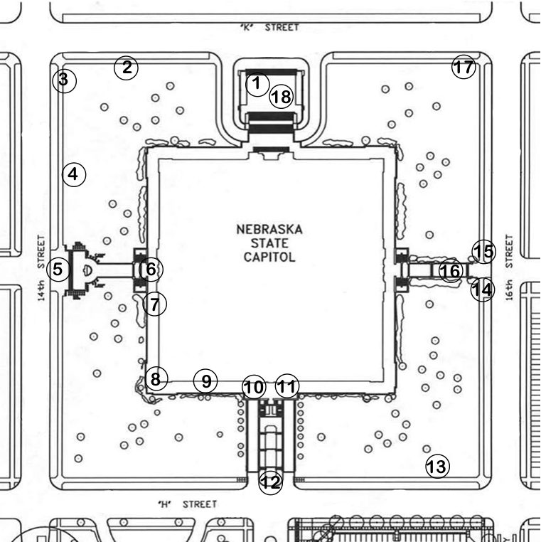
1. Front of the Capitol on K Street
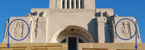
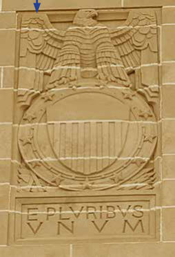
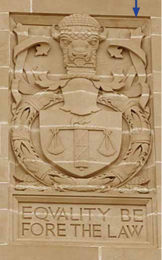
Looking at the Nebraska State Capitol we can learn many things about community. Up on the outside walls of the two corners of the main entrance are symbols of Nebraska and the United States. On the right is a coat of arms designed to represent the state of Nebraska. The bison head on top shows that Nebraska is part of the Great Plains. We share a geographical, plant and animal based community with other prairie states, such as Oklahoma, Kansas, South and North Dakota, it includes the eastern parts of Colorado and Wyoming. The relief carving includes our state motto, Equality Before The Law. (SS3.1.2.b) On the other corner is a carving to represent the United States, the seal has the shield with stars, stripes and an eagle to remind us we are part of the community of states that make up the United States of America.
Lincoln is the capital of Nebraska and the capitol houses Nebraska’s government. The spellings are different depending on if we are talking about the city or the building. When Lincoln was chosen as the capital city in 1867 there were less than 100 people in the small town of Lancaster, which was renamed Lincoln. When this capitol was built between 1922 and 1932 there were 50,000 people living in Lincoln. Now there are over 275,000. Lincoln is the second largest city in Nebraska, Omaha is the largest. Nebraska is made up of a few large and many small communities. In all Nebraska’s communities, citizens live and work together to make the state a better place. The Capitol is a symbol of our state. The base is wide and flat like the prairie landscape is wide and flat. The tower rises up 400 feet from the center of the building to represent our hopes and dreams to build a better state.
There are over 900 people who work in the Capitol. Those workers make the Capitol’s population larger than some Nebraska towns. Nebraska’s 93 counties are carved in stone on the Capitol in a border around the outside reminding us this building belongs to all citizens of our state. Lincoln was first called Lancaster after a town in Pennsylvania from where some of the first settlers had come. It was renamed after Abraham Lincoln when it was made the capital upon statehood. As you walk around the Capitol find Lancaster, now the name of the county which includes the city of Lincoln. Nebraska also named a county after President Lincoln. As you walk around look for Lincoln County.
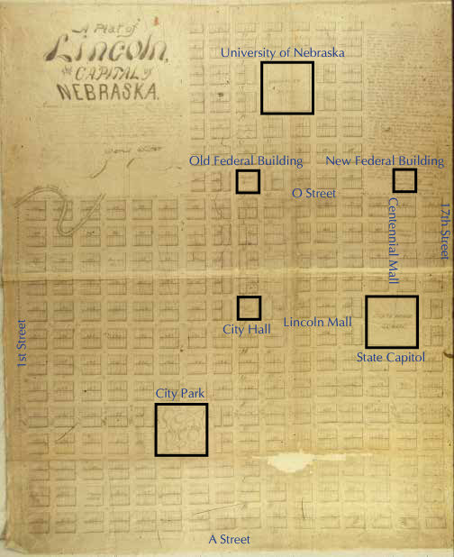
The City of Lincoln has office buildings for the three levels of government. (SS3.1.1a) When the first Capitol Commission laid out the street plan or plat for Lincoln, they set aside specific areas for these three levels of government: the local, county and city government, state government and the federal government. (SS3.3.1b) The county/city buildings and the state capitol are in the same location as they were in 1867. The federal government office building moved from its original location at 10th and P Street to its new location at 15th and P Street. Now the three levels of government are located along the Centennial and Lincoln Malls, with the Capitol at the intersection of the malls.
East side of Capitol South of east entrance
North side of Capitol East of north entrance
State Capitol
Old Federal Building
City Hall
University of Nebraska
1st Street
17th Street
A Street
O Street
City Park
1867 Lincoln Original Plat Map
New Federal Building
Lincoln Mall
Centennial Mall
2. Walk west along K Street
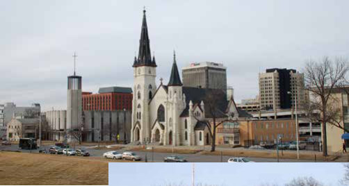
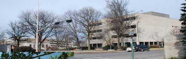
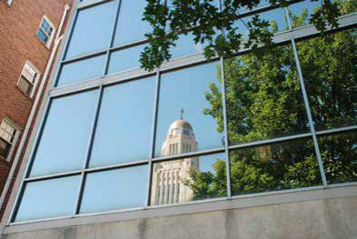
The city of Lincoln has grown since they finished the Capitol. As more buildings have been built downtown, they have copied the Capitol. Many of the buildings are made of light yellow stone or brick similar in color to the Capitol’s Indiana Limestone façade or exterior walls. (SS3.3.2a) The computer building across 14th Street incorporates the Capitol’s tower into the design in the bricks on the façade or face of the building. The Executive Building south of the computer building has a glass front which reflects the beautiful Capitol like a mirror. The two churches across the street north and east are the same color as the Capitol, one is painted brick and one is limestone. The Stuart Building, the Sharp Building, the Wells Fargo Bank, the Embassy Suites, the Federal building, and the Walgreen’s store downtown are all the same color as the Capitol. Once you start looking you will see many buildings downtown which copy the Capitol. The design of the West Stadium copies the turrets or corner towers at the top of the Capitol in its design, and it is the same color as the Capitol. Can you see any buildings around the Capitol made of limestone? Nebraska State Education Association on the west side and the Administrative Building on the north side are built of limestone.
3. At the NW corner 14th and K Street
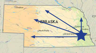
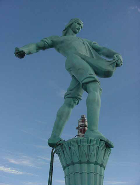
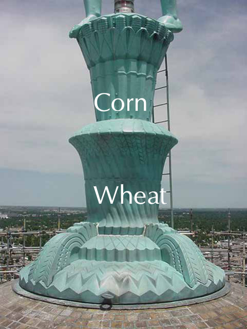
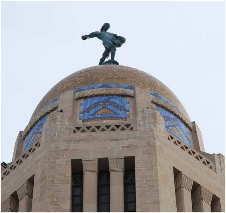
At the top of the Capitol is the Sower. The statue is a symbol of Nebraska’s agriculture. As he stands on top of the Capitol he faces north and west because most of the state of Nebraska is located north and west of Lincoln. He looks out toward the rest of the state. The Sower is 19 feet tall and weighs 9 ½ tons. He stands on a pedestal made to look like stocks of corn and wheat reminding us of crops that Nebraska’s farmers grow (SS3.3.2b) and the two main crops of the native Americans and pioneers. The Sower is another symbol used by many different groups and people in the community to represent Lincoln. When you look at the Lincoln Journal Star notice the masthead of the newspaper has the Sower included in it.
Corn
Wheat

4. Walk toward the Lincoln Monument
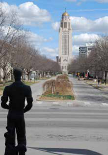
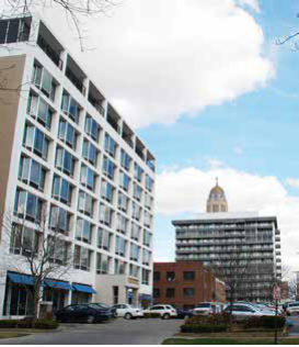
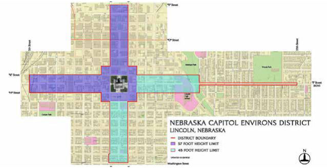
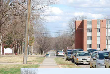
The Capitol’s architect Bertram Goodhue thought that there should be four malls or landscaped streets leading out away from the Capitol into the city. Because the Capitol’s design or floor plan is a plus sign in a square on four square city blocks, the malls down the streets carry the Capitol’s design or plan out into the city. North of the Capitol is Centennial Mall leading to the University of Nebraska with the Denney Federal Building along the way. West of the Capitol is Lincoln Mall which leads to the Hall of Justice and County/City Building. These malls are intended to provide a long open view of the Capitol’s tower. West along Lincoln Mall there are two tall apartment buildings. Once they were built state officials began to worry that many tall buildings would be built around the Capitol and lessen its importance in the city and skyline view. (SS3.1.1.b) In 1977, the Legislature passed a law limiting the height of buildings along the malls and around the Capitol to four stories. They established the Capitol Environs Commission with membership from both the state and the city and gave them the task of protecting the views of the Capitol and the environs or streetscape around the Capitol. They wanted to make sure the capitol was the most important building in the capital city.
5. At the Lincoln Monument
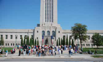
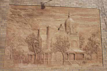
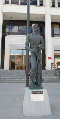
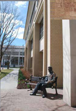
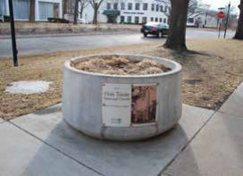
The Lincoln Monument was created to celebrate Abraham Lincoln’s 100th birthday. It was dedicated on September 2, 1912. (SS3.4.1c) Over 10,000 people stood here and filled 14th Street as they watched two Civil War veterans unveil the statue. This monument was created by the same artist, Daniel Chester French, and architect, Henry Bacon, who created the Lincoln Memorial on the National Mall in Washington, D.C. This monument was built ten years before the one in Washington and ten years before they started building this capitol. Abraham Lincoln was an important president and along Lincoln Mall there are famous quotes by Abraham Lincoln as well as two more statues of Lincoln. Also along Lincoln Mall there are pictures of the buildings, houses and churches which used to be there before they were torn down for new buildings. Citizens of Lincoln and Nebraska use this plaza space to engage in civic participation. (SS3.1.2.a) Citizens who have the same ideas on issues and laws (another kind of community) will meet here for news conferences and rallies and tell their local, state and federal elected leaders what they want government to do for them. Then they will go inside the Capitol to meet with senators or the governor, or walk from the Capitol to the Federal Building or to the City Hall to meet with other elected officials. This is one way citizens can participate in their government, one of our civic responsibilities.
6. Walk through the monument and up onto the promenade
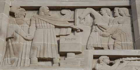
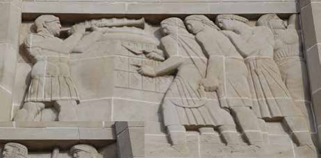
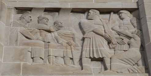
Above the WEST entrance on the pavilion, or large protruding wall, are relief sculptures representing the three branches or parts of government. The Capitol houses this community of government–the Executive, Legislative and Judicial branches of government. (SS3.1.1) The executive branch includes the president of the nation, the governor of the state, and the mayor of the city. The Legislative branches makes the laws for the United States and Nebraska just like the city council makes the laws for Lincoln. The judicial branch has the Supreme Court which makes sure all the lower courts, like the county courts in the Hall of Justice straight west, follow the rules as they hold trials. In the three relief panels, the panel on the left shows the Executive branch. An ancient Greek leader named Solon is on the left standing tall with his arm out pointing to the citizens telling them what he is going to do as their leader to make life better for them. The panel in the center represents the Legislative branch and shows citizens looking at new Roman laws which have been posted on the wall. A herald blows on a horn to call everyone to come and read the laws the senators have made and to follow them. The right hand panel represents the development of the judicial branch in ancient Rome and shows three people sitting in judgment as a father goes before them to plead for his daughter to be set free. (SS3.4.4e) All these events from ancient civilizations have influenced our modern government and how we govern ourselves.
7. Move a little to the south and look at the next relief panel
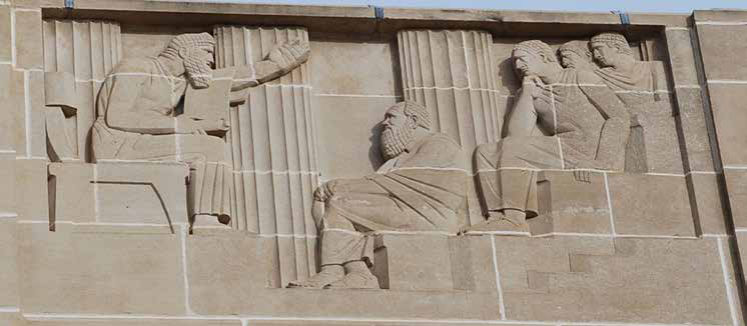
The next sculpture or relief represents the idea that education is an important part of citizenship. Teachers, students, parents and alult learners form a community of education. A teacher is in front of a group of students. These students are grown-ups, reminding us that everyone, and especially voters, need to learn about issues to better participate in government. (SS3.2.10) One of the services government provides is education. We pay taxes to help fund schools for children to learn, that is local government and the school board providing a service for citizens. State government helps to fund the university, state and community colleges. Government at all levels provides funding for roads and then provides education about the rules of the road by printing driver’s manuals for citizens to read and learn. Government provides the licenses we need to register cars and to drive our cars. Government makes sure we obey the traffic laws by allowing the police to give drivers tickets for speeding and other violations.
8. Walk to the southwest corner of the promenade deck
The first communities in Nebraska were built along the Missouri River since the waterways were the first routes westward used by the Spanish, French and Lewis and Clark expeditions. Omaha, on the Missouri River was chosen as the territorial Capital in 1854. Then, the Overland Trails and railroads expanded settlement out into the state away from the Missouri River. When Nebraska became a state in 1867 they wanted to move the Capitol away from Omaha and out to the edge of settlement at the time. (SS3.3.1c) The first Capitol Commission chose Lancaster as the capital site because when they visited Ashland, near where Salt Creek enters the Platte River, there were too many mosquitos; at Yan- kee Hill they thought they were being bribed with ice cream. The early settlers of Lancaster had dug wells where Cooper Park and Antelope Park are now. They found enough drinking water to begin their city, so the Commission thought it was a good place for a town. Being near Salt Creek, some of the early settlers thought they could have a salt mining industry and make money. There wasn’t enough salt available to make any money, but there was enough salt to make future wells too salty for drinking wa- ter. Now the City of Lincoln gets its water from wells near Ashland, a town that could have been chosen as the Capitol. City government and the Lincoln Water System brings the water to Lincoln through miles and miles of pipes.
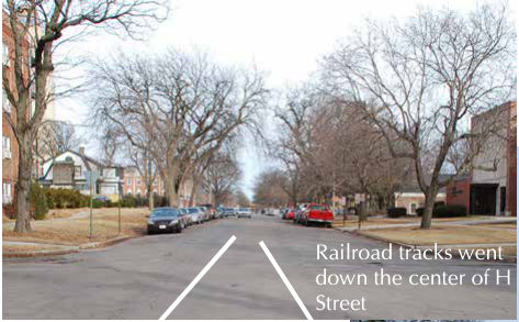
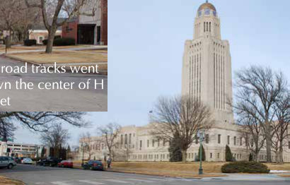
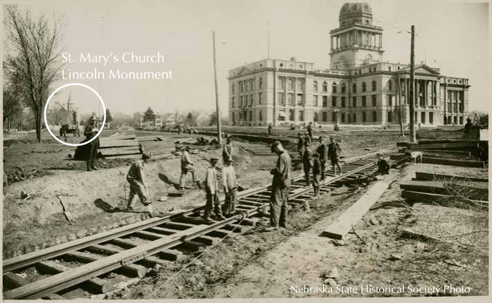
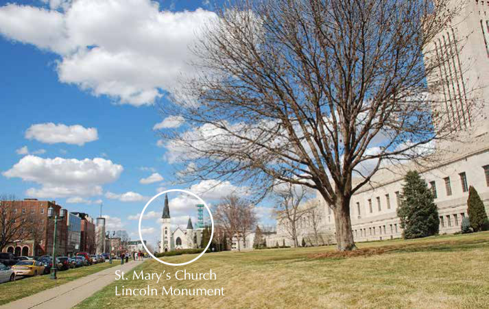
When they began building this Capitol in 1922 they had to bring lots of heavy limestone from Indiana and marble from Europe, as well as heavy Nebraska made bricks, to the site. There weren’t a lot of cars or trucks used at that time. Most of the transportation between cities and states was by trains or railroads. The people who built this capitol, the Capitol Commission, decided it would be cheaper to bring the railroad to the Capitol than unload all the heavy material and try to bring it here in little trucks or horse drawn wagons. (SS3.2.2) The state owned railroad tracks which came down H Street from the west and entered the site from the southwest corner of the Capitol grounds. The railroad track ran all the way around the Capitol and was removed once the Capitol was completed, having saved the state money during the capitol’s construction.
Railroad tracks went down the center of H Street
9. Move around the corner to the south and look across at the Governor’s Residence
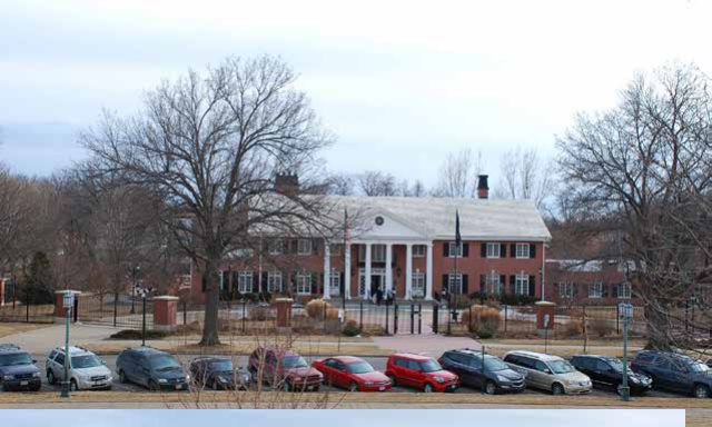
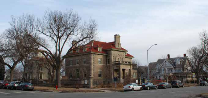
Nebraska’s Governor lives in a home provided by the citizens or taxpayers. (SS3.2.10) The Governor’s Residence was built in 1958 and has 31 rooms, including 5 bedrooms and 12 bathrooms, 4 fireplaces and a 3-stall garage. Looking to the east of the Governor’s home is a parking lot and east beyond that are the beige brick Ferguson House, the Kennard House painted gray, and the Yates House, the big blue house with fancy wood work around the windows and porches. These three big houses are the only ones left near the Capitol. Before they built the office buildings and parking lots around the Capitol there were many very big houses just like these surrounding the Capitol. Further south and east of the Capitol there are still big houses and apartments in the Near South neighborhood which were built over 100 years ago.
10. Move east to the top of the south stairs
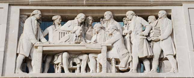
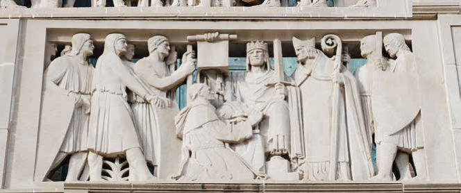
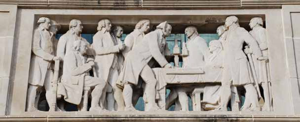
Turn around and look up at the relief sculpture under the big arched windows. Each represents individuals working together as a community to have a say in their government. The Declaration of Independence (SS3.1.2b) is represented on the left, and the United States Constitution is on the right. The middle panel shows King John of England presenting his subjects with a charter or contract saying the King will follow the same rules and laws as his people. It also allowed the people to make decisions and hgave a say about their government. It was from the rule of an English king that didn’t let the colonies or communities of America have a say that the 13 colonies revolted when they declared their independence. (SS3.4.2.a) Nebraska became the 37th state joining the community of the United States in 1867.
11. Turn and look south down the street
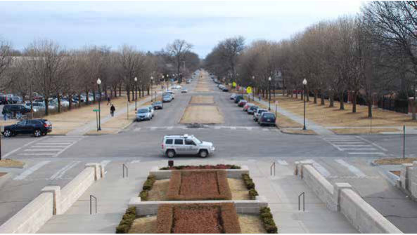
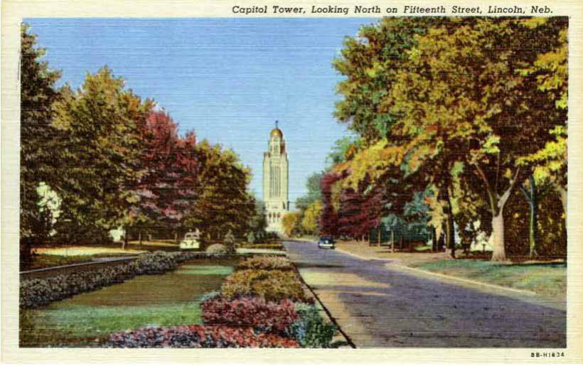
South of the Capitol leading to A Street is another mall or boulevard. This street with grassy islands makes a special road to the Capitol and it was like this when the Capitol was completed in 1932. This mall or boulevard was built in 1912 at the same time as the Lincoln Monument. (SS3.2.10) Governments spend money improving the urban environment to make our cities more beautiful and livable. The city and state have created Centennial Mall and Lincoln Mall to improve the appearance of downtown Lincoln and the Capitol. The original street plan or plat of Lincoln called this 15th Street and it ended at A Street. The street was renamed Goodhue Boulevard to honor the Capitol’s architect Bertram Goodhue. City councils can rename a street to honor an important person. Lincoln city council renamed K and L Street west of 9th Street Rosa Parks Way to honor Rosa Parks, an important civil rights figure.
12. Move south down the stairs and to public sidewalk
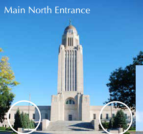
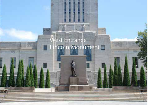
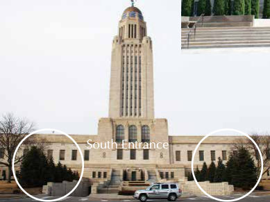
Plants form a community of the environment, a natural or man-made environment. The plants around the Capitol highlight different parts of the building as people come to visit and work. (SS3.3.2.a) Here where many of the 900 Capitol staff walk up the steps to enter they planted different shrubs as a community. Some have colored leaves and some have flowers. Since people walk close to the shrubs they can see how plants work together to make the entrance pretty. In downtown Lincoln they have planted native trees, flowers and native grasses close the sidewalks so people can see what kind of plant communities grew on the prairie. Different plants lived together and supported each other. (SS3.3.2.b) The plantings downtown also make it nicer to visit and walk around. Outside the dock walls, big evergreen trees are planted to help show visitors this area is an entrance to the Capitol. There are special plantings on the north, west and south sides of the Capitol to help identify those entrances. The community of trees on the West Plaza make the Lincoln Monument appear separate from the Capitol.
Main North Entrance
West Entrance Lincoln Monument
South Entrance
13. Walk to the east side
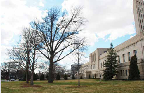
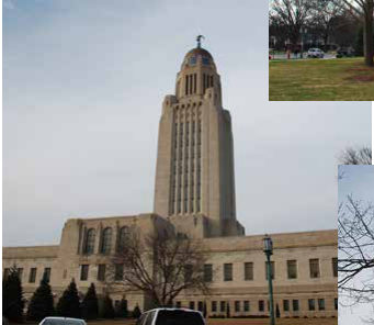
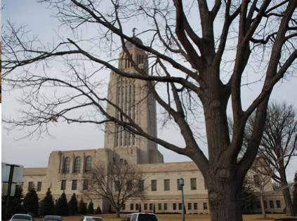
Notice on the Capitol’s grounds there is a community of small, medium and large trees. (SS3.3.2.a) The very large trees were planted when they finished the Capitol 80 years ago. Trees get old, so we need to plant new ones to take their place and maintain the landscape architect’s grounds plan. You can see some of the newer trees which were planted to take the place of the big ones once they are gone. We plant a community of different trees, oaks, maples and elms, so disease and bugs won’t hurt them all. Notice that there are no big street trees on the Capitol side of the street. The big trees are across the street so people driving by the Capitol can see how beautiful it is. If there were trees on the Capitol side of the street they would block the view of people walking on the sidewalk, riding by on their bike, or driving in their car.
14. At the east entrance by the street
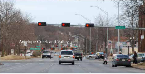
Look east; see how J Street doesn’t make a straight line. The original plat or plan of Lincoln ended with 17th Street. Later when they decided to add more land to the city and build streets, they made a smaller right of way and moved J Street to the north, so it doesn’t line up. As you look east you can see how J Street drops down into a valley. This is Antelope Valley. (SS3.2.10.a) The city and natural resource district spent lots of tax money to create a new water way for Antelope Creek and build a new road beside it, this is a community of safety. The channel will hold the extra water when Lincoln gets a heavy rain and rain water runs off the streets, parking lots, and roofs of houses and businesses. The new road make it safer for people to move through downtown and campus. This means that the taxpayers have made property which once flooded or hard to reach more valuable and available for development. The city has turned this new waterway or creek into a long narrow park. Antelope Creek starts beyond Holmes Lake, goes past the Children’s Zoo, comes here close to the Capitol and then flows under the bridges on N, O, P, and Q Streets. It joins Salt Creek near Cornhusker Highway and 14th Street. (SS3.3.3.b) Lincoln has many streams flowing through the city including Beal Slough by Highway 2; Dead Man’s Run by Gateway Mall and University Place, Haines Branch and Middle Creek by Pioneers Park.
Antelope Creek and Valley
15. Look up at the Capitol
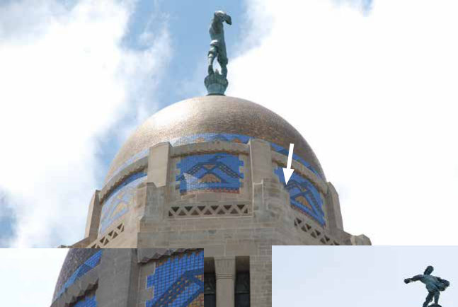
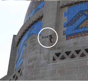
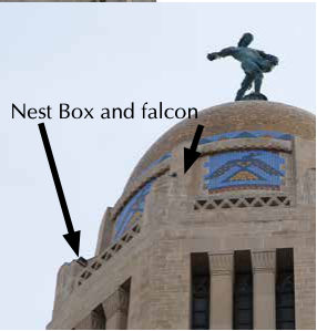
Peregrine Falcons are raptors or hunting birds, which usually live high on cliffs. In 1990, one flew past the Capitol and thought it was a cliff and decided to make the Capitol his home. After the second year he lived here workers at the Capitol built a nest box for him to call home. He found a mate and she has been laying eggs and hatching baby falcons, they have formed a community of nature and humans at the Capitol. In the spring Capitol staff and others watch the falcons via a camera. Many people think of the falcons and chicks as part of their community and care what happens to them. The nest box is located way up by the Thunderbird mosaics on one of the side ledges. If you look closely you can see the nest box. Capitol workers tried to make it angular in design so it would blend in with the angles of the Capitol’s architecture. Sometimes if you look closely you can see the Peregrines sitting up on the ledges at the top of the building, or you can see them flying around the golden dome. This is one way that animals have adapted to the human environment, thinking a tall building is a cliff, and live where they didn’t live before, there are few cliffs in Nebraska and in the past there were few Peregrine Falcons in Nebraska. (SS3.3.2.a)
Nest Box and falcon
16. Walk half way to the east door and look up at the East Entrance Pavilion
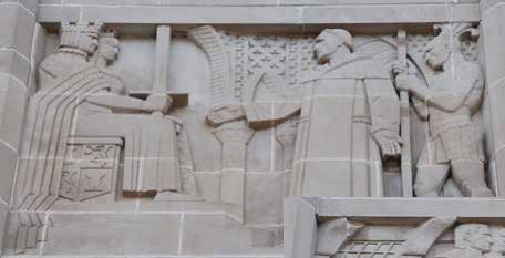
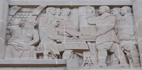
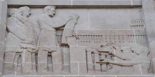
These three relief panels represent freedoms we have achieved in the new world as we work to build a community of equality for all people. The two outside panels represent freedom from slavery. The left panel represents a Spanish Priest, Bartholomew de Las Casas, who brought Native Americans to Spain to show King Ferdinand and Queen Isabella and tell them they should not be made slaves in the Span- ish South American colonies. The right panel shows President Lincoln with the Emancipation Procla- mation freeing African slaves during the Civil War. We celebrate Columbus Day to commemorate the Spanish explorer Christopher Columbus sailing his boats to the new world. Before the pilgrims left the Mayflower and came ashore in North American they created a document to govern themselves as a civil body for better order and to make laws for the general good of the colony. The center panel shows a mother and child looking out the window at their new home which will have a new set of rules for self government. Thanksgiving as a reminder of their hard work in the creation of a new colony in what would become the state of Massachusetts.
17. Walk to the northeast corner of the Capitol
Look up at the Thunderbird designs on the top of the Capitol beneath the golden dome. The Thunderbirds are a Native American symbol to represent the rain. There were many different Native American tribes or communities of Frist People living in Nebraska. These communities of the First People had different ways of dressing and living, some were farmers and some were hunters, but they shared some common beliefs, such as the Thunderbird. The Thunderbirds are placed up near the Sower to remind us that the rain is needed to help us grow crops and have food. The tribes believe the giant bird brings the rain, flapping its wings to make thunder and blinking its eyes to make lightning. Many of Nebraska’s farmers rely on irrigation or big water sprinklers to provide water for crops. Rain water goes into the ground to fill the aquifers where we draw our groundwater, so rain is still as important to Nebraska’s agricultural communities as it is to Native American communities.
18. Walk to the north entrance steps
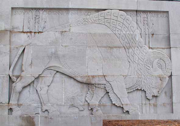
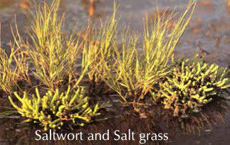
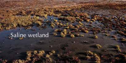
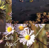
On the walls along the steps are Native American designs. There are bison with Native American poems and prayers carved on them. The names of the tribes that once lived and hunted in Nebraska are carved into the limestone walls along with corn. Before the pioneers came and settled Nebraska, before Lincoln became a town, Native Americans came to this area to gather salt from Salt Creek and the saline wetlands west of downtown. Capitol Beach Lake and Oak Lake are what is left of the huge saline wetland area along Salt Creek. Saline is another word for salty. That’s how Salt Creek got its name. Saline wetlands have a very unique plant community growing together, they contain plants that are able to live in salty soil and water. Some of the early settlers of Lancaster, as Lincoln was first named, thought they would be able to have a business gathering the salt from the wetlands. (SS3.2.2) But it turned out there wasn’t enough salt to have a business. They stayed anyway and formed a town which became the state capital of Nebraska — Lincoln.
Saltwort and Salt grass
Saline wetland
Salt Aster Community page 22